WordJot Trial Mode.   Need a blog or email newsletter? Try WordJot Blogs

Logger Tracks in Google Earth

Posted 16 years, 5 months ago    3 comments

Wouldn't it be nice to view your gliding track in the beautiful 3D high resolution Google Earth? gpsvisualizer.com converts the IGC files, produced by our club loggers, into Google Earth KMZ files. This can then be opened in Google Earth and visualised in 3D just like SeeYou.

Here's what it looks like:
Nice smooth ride down

How to escape from TeAroha 1000 feet: lots of circles

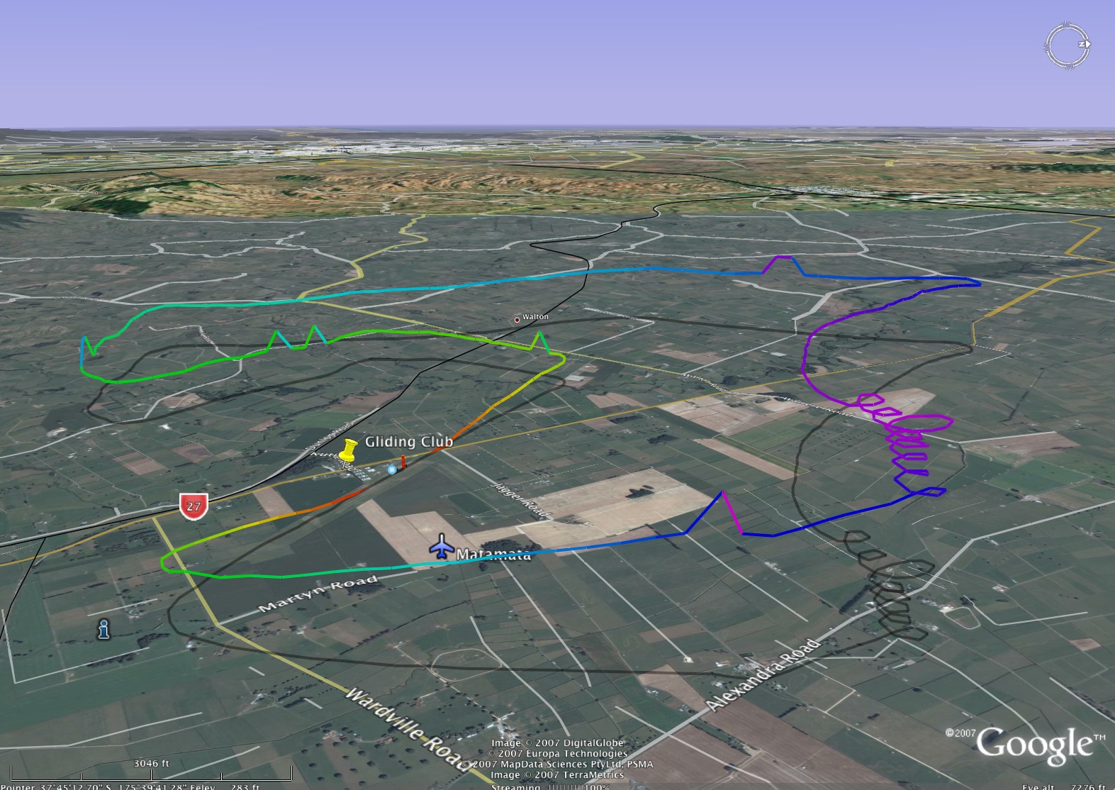
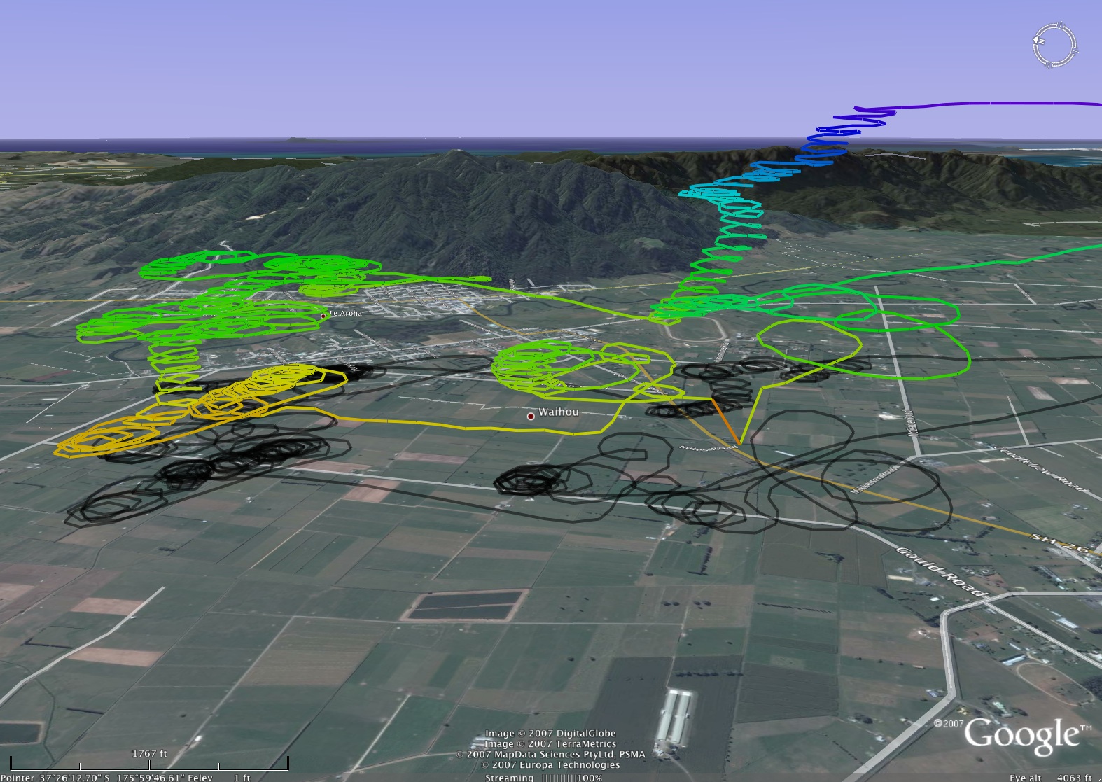
A number of settings on the gpsvisualizer google earth converter page need to be changed to produce the views above. Here's what I changed:
- Set Altitude mode to: "Absolute"
- Colorize by: "Altitude"
- "Draw a shadow" to 30% or what ever you like to see the ground track
- "Units" to US, to view in feet and miles (or should it be Nautical?)

Here's what the settings look like:
Settings set, click image for larger version

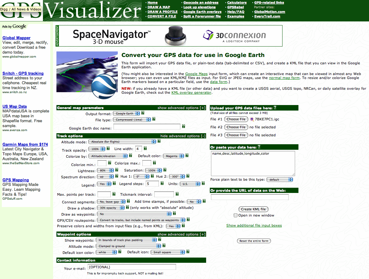
Here's the website link again: www.gpsvisualizer.com/map?form=googleearth

Comments

16 years ago
The "Units" setting only affects the OUTPUT, so U.S. vs. Nautical won't make any difference unless you are colorizing by speed or distance and want to see what it says in the legend.

The altitude measurements are always read correctly from the data files, especially if they're in IGC format.
karaka
15 years, 10 months ago
Have you tried IGC Logger at
http://www.ywtw.de/igcsim.html
Also a IGC file replay in Google earth
15 years, 10 months ago
Hi no I haven't tried that, unfortunately I'm on a Mac so can't run windows software easily. That web version works on all platforms which is nice.

Email this page...     Link to this page...
Shim